


What are celestial coordinates, and why are they important?
December 3, 2008
From our point of view on Earth, the sky is a sphere. If you stretch out or project the geographical coordinates of Earth into space, a gridwork of celestial coordinates is formed on the sky–just like the Earth’s spherical surface. The celestial sphere will have an equator and poles, plus the equivalents of latitude and longitude. This makes it easy to measure positions on the sky.
The celestial equator is a full 360 degree circle splitting the celestial sphere into the northern and southern celestial hemispheres or simply the northern and southern sky. It is the projection of our equator in space and is directly overhead at the Earth’s equator. Measurements north and south on the sky are called declinations (commonly abbreviated as Dec, DEC or dec). Similar to latitude, declination is measured in degrees, minutes and seconds north (positive) and south (negative), with 60 minutes in each degree and 60 seconds in each minute of declination. The celestial equator is 0 degrees declination, and the north and south celestial poles are +90 and -90 degrees.
Measurements east and west on the sky are called right ascensions (commonly abbreviated RA, R.A.). RA is measured in hours minutes and seconds of time. The reason is that the sky turns once a day to the west as the Earth rotates to the east. The celestial sphere moves one hour of RA west per hour of time and 24 hours of RA during the course of the entire day. Since this is a 360 degree rotation, one hour of RA is equal to 15 degrees of turning (360/24 = 15). Just like lines of longitude, RA lines are also great circles converging on the north and south celestial poles.
Longitude is 0 degrees at the Greenwich meridian, as the zero line divides east and west. On the sky, the zero meridian in RA is labeled 00h 00m 00s. It intersects the celestial equator at a point called the vernal equinox (where the Sun crosses the celestial equator in late March of each year).
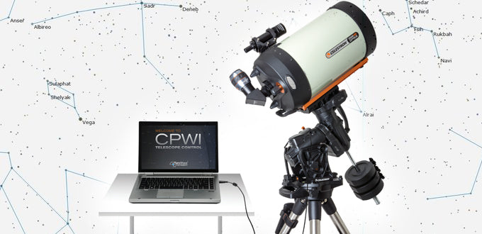
These are the basics of the celestial coordinate system. They relate to your telescope because, whether it’s a GoTo scope or a manual equatorial mount, it uses these coordinates to find objects in the sky just like latitude and longitude are used to find cities, mountains and towns on the Earth.
Updated 12/20/13
The celestial equator is a full 360 degree circle splitting the celestial sphere into the northern and southern celestial hemispheres or simply the northern and southern sky. It is the projection of our equator in space and is directly overhead at the Earth’s equator. Measurements north and south on the sky are called declinations (commonly abbreviated as Dec, DEC or dec). Similar to latitude, declination is measured in degrees, minutes and seconds north (positive) and south (negative), with 60 minutes in each degree and 60 seconds in each minute of declination. The celestial equator is 0 degrees declination, and the north and south celestial poles are +90 and -90 degrees.
Measurements east and west on the sky are called right ascensions (commonly abbreviated RA, R.A.). RA is measured in hours minutes and seconds of time. The reason is that the sky turns once a day to the west as the Earth rotates to the east. The celestial sphere moves one hour of RA west per hour of time and 24 hours of RA during the course of the entire day. Since this is a 360 degree rotation, one hour of RA is equal to 15 degrees of turning (360/24 = 15). Just like lines of longitude, RA lines are also great circles converging on the north and south celestial poles.
Longitude is 0 degrees at the Greenwich meridian, as the zero line divides east and west. On the sky, the zero meridian in RA is labeled 00h 00m 00s. It intersects the celestial equator at a point called the vernal equinox (where the Sun crosses the celestial equator in late March of each year).
These are the basics of the celestial coordinate system. They relate to your telescope because, whether it’s a GoTo scope or a manual equatorial mount, it uses these coordinates to find objects in the sky just like latitude and longitude are used to find cities, mountains and towns on the Earth.
Updated 12/20/13